Jhalrapatan
Jhalrapatan | |
|---|---|
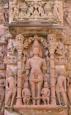
 Surya Statue, Jhalrapatan in Jhalawar district, Rajasthan, India | |
| Nickname: City of Bells | |
| Coordinates: 24°33′N 76°10′E / 24.55°N 76.17°E | |
| Country | |
| State | Rajasthan |
| District | Jhalawar |
| Founded by | Zalim Singh |
| Named for | bells(jhalar) sound |
| Government | |
| • Type | Municipality |
| Elevation | 317 m (1,040 ft) |
| Population (2011) | |
• Total | 37,506 |
| Languages | |
| • Official | Hindi, Rajasthani, Hadoti |
| • Native | Hadoti dialect |
| Time zone | UTC+5:30 (IST) |
| PIN | 326023(common) |
Jhalrapatan is a city and municipality of India in Jhalawar district in the state of Rajasthan. Its population is approximately 37,506.[citation needed]
A municipality was established at Jhalrapatan in 1892.[1]
History
[edit]Jhalrapatan was founded in 1796 by Zalim Singh,[2] approximately half a mile north of the ruins of Chandravati, which had been destroyed by Aurangzeb.[3]
Education
[edit]Schools in Jhalrapatan include
•Government Engineering College, Jhalawar •Government Higher Secondary School •Government Girls Higher Secondary School •Vasudha Sr. Secondary School •Dr Radhakrishanan Sr Sec School •Gyan Ganga Public School
Geography
[edit]Jhalrapatan is located at 24°33′N 76°10′E / 24.55°N 76.17°E. It has an average elevation of 317 metres (1040 feet).
Demographics
[edit]As of the 2001 India census,[4] Jhalrapatan had a population of 30,103. Males constitute 52% of the population and females 48%. Jhalrapatan has an average literacy rate of 69%, higher than the national average of 59.5%: male literacy is 77%, and female literacy is 60%. 16% of the population is under 6 years of age.
References
[edit]- ^ Rima Hooja (2006). A History of Rajasthan. Rupa. p. 1166. ISBN 9788129108906.
- ^ The Encyclopaedia Britannica: Italy-Kyshtym. At the University Press. 1911. p. 412.
- ^ DHOUNDIYAL, B. N. (1964). Rajasthan District Gazetteer of Jhalawar. GOVERNMENT CENTRAL PRESS, Jaipur. pp. 286–289.
- ^ "Rajasthsan" (PDF). Census of India. 2001. Retrieved 19 April 2010.
External links
[edit] Media related to Jhalrapatan at Wikimedia Commons


